Category:Sully and Lavernock
Jump to navigation
Jump to search
community in the Vale of Glamorgan, UK  | |||||
| Upload media | |||||
| Instance of | |||||
|---|---|---|---|---|---|
| Location | Vale of Glamorgan, Wales | ||||
| Population |
| ||||
| Area |
| ||||
| official website | |||||
 | |||||
Subcategories
This category has the following 4 subcategories, out of 4 total.
L
S
Media in category "Sully and Lavernock"
The following 177 files are in this category, out of 177 total.
-

-
 A caravan park east of Swanbridge - geograph.org.uk - 3273333.jpg 456 × 640; 97 KB
-

-

-
 Access road to Beechwood College, Sully - geograph.org.uk - 3258705.jpg 640 × 553; 115 KB
-
 Arched Railway Bridge - geograph.org.uk - 5285713.jpg 3,264 × 2,448; 3.4 MB
-
 Arlington Road, Sully - geograph.org.uk - 3263874.jpg 640 × 390; 58 KB
-
 B4267 at Sully boundary - geograph.org.uk - 5249180.jpg 640 × 512; 48 KB
-
 B4267 at Ty Verion roundabout - geograph.org.uk - 5249187.jpg 640 × 480; 67 KB
-
 B4267 Lavernock Road - geograph.org.uk - 5249171.jpg 640 × 513; 56 KB
-
 B4267 near The Vineyard - geograph.org.uk - 5249175.jpg 640 × 480; 77 KB
-
 B4267 South Road at Minehead Avenue - geograph.org.uk - 5249183.jpg 640 × 480; 91 KB
-
 B4267 South Road, Sully - geograph.org.uk - 5249182.jpg 640 × 512; 46 KB
-
 B4267 Sully Moors Road - geograph.org.uk - 5249185.jpg 640 × 480; 67 KB
-
 Bell Bay - geograph.org.uk - 5069501.jpg 3,264 × 2,448; 3.48 MB
-
 Boardwalk reflections - Cosmeston Lakes - geograph.org.uk - 2017667.jpg 2,000 × 1,500; 3.41 MB
-
 Boardwalk shadows - Cosmeston Lakes - geograph.org.uk - 2017646.jpg 2,560 × 1,920; 5.27 MB
-
-
 Breaksea Close, Smithies Ave, Sully - geograph.org.uk - 2767108.jpg 3,296 × 2,472; 1.86 MB
-
 Bridge carrying dismantled railway over Swanbridge Rd, Sully - geograph.org.uk - 2764786.jpg 3,296 × 2,472; 1.77 MB
-
 Bridge carrying dismantled railway over Swanbridge Rd, Sully - geograph.org.uk - 2764794.jpg 3,296 × 2,472; 1.77 MB
-
-

-
 Brook Cottage and Brook - geograph.org.uk - 5069037.jpg 2,448 × 3,264; 942 KB
-
 Brook Cottage, Cog Bridge - geograph.org.uk - 2764736.jpg 3,296 × 2,472; 1.79 MB
-
 Building site near Sully - geograph.org.uk - 3258716.jpg 640 × 398; 95 KB
-
 Burnham Avenue, Sully - geograph.org.uk - 3263783.jpg 640 × 371; 51 KB
-
 Buttercup bank - geograph.org.uk - 6151127.jpg 3,006 × 2,126; 2.88 MB
-
 Cadoxton River near Barry - geograph.org.uk - 3255420.jpg 640 × 577; 165 KB
-
 Children's Play Area - geograph.org.uk - 5461958.jpg 3,264 × 2,448; 1.33 MB
-

-
 Churchyard cross, Sully - geograph.org.uk - 2767121.jpg 3,296 × 2,472; 1.82 MB
-
 Cliffs at Lavernock Point - geograph.org.uk - 3330630.jpg 640 × 480; 116 KB
-
 Cliffs, south shore, Sully Island - geograph.org.uk - 4902839.jpg 5,184 × 3,456; 7.29 MB
-
 Coastal footpath, Sully - geograph.org.uk - 2767113.jpg 3,296 × 2,472; 1.96 MB
-
 Coastal path near Lavernock - geograph.org.uk - 2001877.jpg 640 × 480; 58 KB
-
 Cog Bridge (over Sully Brook), Sully Rd - geograph.org.uk - 2764732.jpg 3,296 × 2,472; 1.8 MB
-
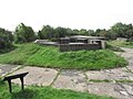
 Concrete Bunker - geograph.org.uk - 5069484.jpg 3,264 × 2,448; 2.79 MB
-
 Cosmeston Drive, Lavernock - geograph.org.uk - 2185771.jpg 640 × 480; 63 KB
-
 Cosmeston Park - geograph.org.uk - 5285718.jpg 3,264 × 2,448; 2.94 MB
-
 Cycle path near Penarth - geograph.org.uk - 1905059.jpg 480 × 640; 139 KB
-
 Distances from Sully - geograph.org.uk - 3258731.jpg 640 × 527; 102 KB
-
 Eastern boundary of Sully - geograph.org.uk - 3273197.jpg 640 × 537; 84 KB
-
 Eastern side of Swanbridge beach - geograph.org.uk - 3273257.jpg 640 × 386; 63 KB
-
-
 Elm Close, Sully - geograph.org.uk - 3263892.jpg 640 × 480; 65 KB
-
 End of the footpath, Cosmeston, Penarth - geograph.org.uk - 2192853.jpg 640 × 610; 147 KB
-

-
 Entrance to Barry Power Station - geograph.org.uk - 3258182.jpg 640 × 515; 65 KB
-

-
 Entrance to The Bay Caravan Park, near Swanbridge - geograph.org.uk - 2767082.jpg 3,296 × 2,472; 1.89 MB
-

-
 Field entrance near Dros-y-Mor - geograph.org.uk - 3273436.jpg 640 × 461; 114 KB
-
 Footpath, children's playground and Jubilee Hall, Sully - geograph.org.uk - 2767111.jpg 3,296 × 2,472; 1.91 MB
-
 Former railway bridge near Lavernock - geograph.org.uk - 1972892.jpg 640 × 480; 120 KB
-
 Former railway bridge near Lavernock - geograph.org.uk - 1972897.jpg 640 × 480; 133 KB
-
 Former windmill near Sully - geograph.org.uk - 1972846.jpg 640 × 480; 106 KB
-
 Hayes Road near Sully - geograph.org.uk - 3258703.jpg 640 × 534; 108 KB
-
 Home Farm, Cog - geograph.org.uk - 2764758.jpg 3,296 × 2,472; 1.87 MB
-
 Home Farm, Cog - geograph.org.uk - 2764782.jpg 3,296 × 2,472; 1.88 MB
-
 House and driveway near Swanbridge - geograph.org.uk - 1972884.jpg 640 × 480; 111 KB
-

-

-
 Houses in Swanbridge Road, Sully - geograph.org.uk - 2762878.jpg 4,000 × 3,000; 1.45 MB
-
 Houses, Sully - geograph.org.uk - 2767122.jpg 3,296 × 2,472; 1.81 MB
-
 Houses, Upper Cosmeston Farm - geograph.org.uk - 2185788.jpg 640 × 442; 60 KB
-
 Industrial Complex at Barry - geograph.org.uk - 1972843.jpg 640 × 480; 56 KB
-
 Industrial complex between Palmerstown and Sully - geograph.org.uk - 2101498.jpg 2,048 × 1,536; 1.29 MB
-
 Junction of Beach Rd and Lavernock Rd, Sully - geograph.org.uk - 2767103.jpg 3,296 × 2,472; 1.84 MB
-
 Junction of Swanbridge Rd, Sully Rd and Cog Rd, at Cog - geograph.org.uk - 2762874.jpg 4,000 × 3,000; 1.64 MB
-

-
 Knowbury Avenue, Cosmeston - geograph.org.uk - 2185409.jpg 640 × 480; 81 KB
-
 Lavernock Point - geograph.org.uk - 3330643.jpg 640 × 480; 71 KB
-
 Lavernock Point - geograph.org.uk - 3330648.jpg 640 × 480; 107 KB
-
 Lavernock Point - geograph.org.uk - 3330672.jpg 640 × 480; 112 KB
-
 Lavernock Point - geograph.org.uk - 3330683.jpg 640 × 480; 120 KB
-
 Lavernock Point nature reserve - geograph.org.uk - 2001893.jpg 480 × 640; 108 KB
-
 Lavernock Point nature reserve - geograph.org.uk - 2001897.jpg 640 × 480; 107 KB
-
 Lavernock Point nature reserve - geograph.org.uk - 2001904.jpg 640 × 480; 110 KB
-
 Lavernock Point Nature Reserve, Vale of Glamorgan, Wales.jpg 4,160 × 3,120; 4.62 MB
-
 Lavernock Road near Cosmeston - geograph.org.uk - 3273465.jpg 640 × 591; 97 KB
-
 Lavernock Road, Sully - geograph.org.uk - 3273198.jpg 640 × 606; 107 KB
-
 LDS Motor Factors, Barry - geograph.org.uk - 3255400.jpg 640 × 412; 62 KB
-
 Lesser Black-backed Gull - Cosmeston Lakes - geograph.org.uk - 1821567.jpg 1,200 × 793; 741 KB
-

-
 Magnelfa Larnog - Lavernock Battery - geograph.org.uk - 4637213.jpg 640 × 480; 112 KB
-

-
 Map of Glamorganshire Sheet 051, Ordnance Survey, 1883-1886.jpg 10,647 × 7,127; 4.09 MB
-
 Map of Glamorganshire Sheet 051, Ordnance Survey, 1883-1886.tiff 10,647 × 7,127; 217.1 MB
-
 McDonald's Barry - geograph.org.uk - 3255414.jpg 640 × 412; 57 KB
-
 Minehead Avenue, Sully - geograph.org.uk - 3263781.jpg 640 × 422; 81 KB
-
 Muddy track near St Mary's Well Bay - geograph.org.uk - 3273363.jpg 640 × 480; 100 KB
-
 Nailsea Court, Sully - geograph.org.uk - 2767104.jpg 3,296 × 2,472; 1.87 MB
-

-
 New seawall, Swanbridge - geograph.org.uk - 4905112.jpg 5,184 × 3,456; 7.34 MB
-
-
-
 North Road near Sully - geograph.org.uk - 3255526.jpg 640 × 427; 47 KB
-

-
 Northern boundary of Swanbridge - geograph.org.uk - 3273201.jpg 640 × 486; 99 KB
-
 Northern end of Beach Road, Sully - geograph.org.uk - 3273196.jpg 640 × 510; 101 KB
-
 Ordnance Survey Cut Mark - geograph.org.uk - 5549574.jpg 640 × 512; 85 KB
-

-
 Part of the car park in Lidl, Barry - geograph.org.uk - 5666160.jpg 640 × 480; 55 KB
-

-
 Pentref Cog Village - geograph.org.uk - 4637261.jpg 640 × 480; 98 KB
-
 Post Office - geograph.org.uk - 5069016.jpg 3,264 × 2,448; 1.73 MB
-
 Railway Bridge - geograph.org.uk - 5069036.jpg 2,448 × 3,264; 1.57 MB
-
 Recreation ground, Sully - geograph.org.uk - 2767107.jpg 3,296 × 2,472; 1.95 MB
-

-
 Road junction and signpost at Cog - geograph.org.uk - 2764768.jpg 3,296 × 2,472; 1.81 MB
-
 Rocky beach, St Mary's Well Bay - geograph.org.uk - 2767084.jpg 3,296 × 2,472; 1.9 MB
-

-
 Ruined Building - geograph.org.uk - 5069480.jpg 3,264 × 2,448; 1.85 MB
-
 Schooner Inn, Lavernock - geograph.org.uk - 2185748.jpg 640 × 548; 81 KB
-
 Scorched undergrowth - geograph.org.uk - 6151131.jpg 3,264 × 2,448; 2.8 MB
-

-
 Shore, Swanbridge Bay, St Mary's Well Bay Road - geograph.org.uk - 4905543.jpg 5,048 × 3,366; 4.23 MB
-
 Shoreline at Sully - geograph.org.uk - 1972861.jpg 640 × 480; 87 KB
-

-

-

-
 St Mary's Well Bay - geograph.org.uk - 4637246.jpg 640 × 480; 94 KB
-
 St Mary's Well Bay near Lavernock - geograph.org.uk - 4287943.jpg 1,024 × 768; 161 KB
-
 St Mary's Well Bay Rd, approaching Swanbridge - geograph.org.uk - 2767086.jpg 3,296 × 2,472; 1.88 MB
-
 St. Mary's Well Bay - geograph.org.uk - 2001880.jpg 640 × 480; 67 KB
-
 St. Mary's Well Bay - geograph.org.uk - 221442.jpg 640 × 480; 84 KB
-
 St. Mary's Well Bay Road near Swanbridge - geograph.org.uk - 1972881.jpg 480 × 640; 146 KB
-
 St.Lawrence Church, Lavernock - geograph.org.uk - 5285866.jpg 3,264 × 2,448; 2.39 MB
-
 Stony beach at Swanbridge Bay - geograph.org.uk - 2767097.jpg 3,296 × 2,472; 2 MB
-
 Stony beach, Swanbridge Bay - geograph.org.uk - 2767100.jpg 3,296 × 2,472; 1.99 MB
-
 Stream at Cosmeston - geograph.org.uk - 5285872.jpg 2,448 × 3,264; 3.09 MB
-

-
 Sully Budokan Judo club - geograph.org.uk - 3258714.jpg 640 × 476; 111 KB
-
 Sully Christian Fellowship - geograph.org.uk - 3263772.jpg 640 × 502; 69 KB
-

-
 Sully Island - geograph.org.uk - 6151119.jpg 3,264 × 2,448; 1.52 MB
-
 Sully Island - geograph.org.uk - 6151136.jpg 5,334 × 3,051; 5.68 MB
-
 Sully Island - south shore - geograph.org.uk - 2001832.jpg 480 × 640; 106 KB
-
 Sully Island and causeway - geograph.org.uk - 1972870.jpg 640 × 264; 41 KB
-
 Sully moors - geograph.org.uk - 3258702.jpg 640 × 480; 77 KB
-

-
 Sully Moors Road businesses - geograph.org.uk - 3255422.jpg 640 × 378; 49 KB
-
 Sully Post Office - geograph.org.uk - 3263865.jpg 640 × 408; 57 KB
-
 Sully Sports FC clubhouse - geograph.org.uk - 3264006.jpg 640 × 587; 107 KB
-
 Sully View businesses, Barry - geograph.org.uk - 3255409.jpg 640 × 437; 61 KB
-
 Sunrise over the Bristol Channel - geograph.org.uk - 2790206.jpg 1,600 × 1,200; 481 KB
-
 Swanbridge Bay at low tide - geograph.org.uk - 2001886.jpg 5,956 × 1,817; 1.88 MB
-
 Swanbridge Road houses, Sully - geograph.org.uk - 3269009.jpg 640 × 528; 81 KB
-
-

-
 Swanbridge Road, Sully - geograph.org.uk - 1972863.jpg 640 × 480; 83 KB
-
 The beach at Sully - geograph.org.uk - 1971893.jpg 1,500 × 970; 184 KB
-
 The east end of Sully Island - geograph.org.uk - 1971896.jpg 1,500 × 985; 139 KB
-
 The Homestead, Cog - geograph.org.uk - 2764772.jpg 3,296 × 2,472; 1.8 MB
-
 The Old School, Sully - geograph.org.uk - 2767118.jpg 3,296 × 2,472; 1.8 MB
-
 The Old School, Sully - geograph.org.uk - 3258771.jpg 640 × 389; 68 KB
-
 The road from Swanbridge joins the B4267 - geograph.org.uk - 2767072.jpg 3,296 × 2,472; 1.92 MB
-
 The road to Swanbridge - geograph.org.uk - 3273461.jpg 640 × 480; 103 KB
-
 The Surgery, Sully - geograph.org.uk - 3263743.jpg 640 × 452; 89 KB
-
 The west end of Sully Island and causeway - geograph.org.uk - 1973781.jpg 1,500 × 983; 218 KB
-
 Tower at Lavernock Point - geograph.org.uk - 2434275.jpg 1,024 × 664; 242 KB
-
 Trailer Park near Sully - geograph.org.uk - 3255523.jpg 640 × 356; 36 KB
-
 Treboeth Cattery, Swanbridge - geograph.org.uk - 3273207.jpg 640 × 528; 82 KB
-
 Ty Hafan - geograph.org.uk - 5453167.jpg 3,264 × 2,448; 1 MB
-
-
 Unusual house towers, Sully - geograph.org.uk - 3263776.jpg 640 × 418; 85 KB
-
 View from the Wales Coast Path near Ranny Point - geograph.org.uk - 5826867.jpg 1,280 × 851; 522 KB
-
 View towards Lavernock - geograph.org.uk - 5826703.jpg 1,280 × 851; 493 KB
-
 Wales Coast Path, Cosmeston - geograph.org.uk - 5827757.jpg 1,280 × 851; 511 KB
-
 Welcome to Lavernock - geograph.org.uk - 2185732.jpg 640 × 515; 115 KB
-
 West Point, Sully Island - geograph.org.uk - 2001840.jpg 640 × 480; 80 KB
-
 Western boundary of Sully - geograph.org.uk - 3258701.jpg 640 × 407; 66 KB
-
 Western end of South Road, Sully - geograph.org.uk - 3258729.jpg 640 × 537; 105 KB
-
 Weston Avenue, Sully - geograph.org.uk - 3263862.jpg 640 × 464; 55 KB
-
-
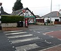 Zebra crossing to Sully Post Office - geograph.org.uk - 3263871.jpg 640 × 536; 80 KB


,_Sully_Rd_-_geograph.org.uk_-_2764732.jpg)


_-_geograph.org.uk_-_5549577.jpg)


